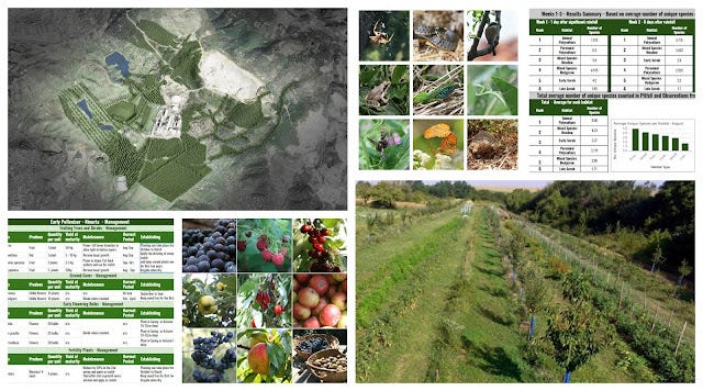
Just one week to go before the arrival of our 2019 Polyculture Study team and we're getting ready and looking forward to another productive year in the gardens.
I'll be posting updates each week here on what we've been up to and Archie will be managing our Instagram account uploading short videos of our activity every few days so if you would like to see what's happening there your can join the page here. Meantime we'll kick off the season here with some observations from the early spring .

 |
| Plants, Seeds, eBooks, Consultancy, Bulk Fruit and Nut Tree Orders for Permaculture, Polyculture, Forest Gardens and Regenerative Landscapes. |
Forest Garden
Our Corylus avellana - Hazelnut plants have been flowering for the last 5 weeks and with the unusually warm and dry spring I expect a decent yield from the 4 year old plants. In the photo below you can see the fully open male catkin empty of pollen and the inconspicuous spider like female flower that is red when fresh but now withering. For a shed load more info on Hazels check out our previous blog The Amazing Hazel - The Essential Guide to Everything you need to know about Hazels
 |
| Corylus avellana - Hazelnut Male and female flowers |
Prunus cerasifera - Cherry Plum are ridiculously full with blossoms this year. This is a 7 year old plant, grown from seed from local wild plants, that I have been trimming back from a pathway the last few years . The result is this wall of blossom. These plants are great for wildlife hedges providing abundant pollen and nectar resources, dense growth suitable for nesting birds such as tits and tasty plums from late June - Late September, depending on the plant.

Prunus armeniaca - Apricot blossoming, so looking forward to these fruits in Early Summer . The fruits from this plant should ripen around the second week of June.

Corydalis bulbosa - Spring Fumewort is one the first plants to emerge from the winter around here and one of my favourite spring ephemerals. The hedgerows and woodlands are littered with these bulbs that are general isolated plants but sometimes they form clumps of 5 or 6 plants as pictured below.

After a few warm days here Vinca minor - Lesser Periwinkle did not waste any time getting their flowers out much to the appreciation of the bees and other pollinating insects. This plant makes an excellent ground cover and if planted out approx. 30 cm between plants can create a thorough cover within 2 seasons.

Tulipa sp. - Tulip find their way through the cover and as you can see in the below photo a Tanacetum vulgare - Tansy that has just starting it's spring growth easily holds its own among the cover. Vinca minor - Lesser Periwinkle is certainly one of the most effective ground cover plants and has the added advantage of being evergreen.

Forsythia europaea, a plant from the olive family Oleaceae, are native here in the Balkans. We have a Forsythia in the garden that I purchased from a nursery here about 8 years ago and it grows well and flowers profusely each year. It surprises me how I never notice bees or other pollinators attracted to the plant but it could be that the nursery plant I bought was the popular garden cultivar Forsythia x intermedia . I'll try and take a look at some the native wild plants that are often growing by the high way road sides to see if they have any pollinator action. I did find this ladybird on one of the branches.

Rubus idaeus cv. - Raspberry emerging. If you leave some of last years stems uncut they will provide the first fruits in June. The new growth coming from the base of the plant will fruit in late September.

Zanthoxylum piperitum - Japanese Pepper Tree a native to E. Asia - N. China, Japan, Korea. has very unusual bark with large spines (thorns) developing as the plant matures. The branches and leaves also have these spines albiet smaller which leads me to believe it is probably vulnerable (or was at some point) to some mammalian herbivore in its native range. The leaves and fruits are very strong tasting making an excellent spice so whatever may want to eat it must have a pretty tough palate.

Market Garden
T1 Solanum lycopersicum Tigeralla
T2 Solanum lycopersicum Ukranian purple
T3 Solanum lycopersicum Chocolate pear
T4 Solanum lycopersicum Alicante
T5 Solanum lycopersicum Yellow pear
T6 Solanum lycopersicum Rozova magia
Tomato seedlings started indoors for planting out in Late April

The rest of the plants for this polyculture will be sown in the coming weeks in trays or directly in the ground. you can find out more about this Annual Vegetable and Herb polyculture here.
Zeno an Annual Vegetable and Herb Polyculture

Sweet Genovese Basil seedlings started indoors for planting out in Late April

For those of you that follow the blog you are probably aware that I am somewhat fond of the marvel that is Symphytum x uplandicum - Comfrey 'Bocking 14'

This week whilst digging up a large order of cuttings for The Forest Farmers, (a start up Regenerative Agroforesty design project in the Netherlands) I found yet another reason to show this plant some love. As the plants mature around the 4th or 5th year the crown center begins to rot and this decomposing material seems to be very attractive to the red worm Eisenia fetida ,our native composting worms. This may be one of the reasons we are observing increased soil fertility around our comfrey plants i.e the castings from these worms are highly fertile.
 |
| Eisenia fetida congregating around the decomposing heart of a 4 year old Comfrey 'Bocking 14' |
We have Comfrey 'Bocking 14' root cuttings from our online store here
Video clips from the Gardens
Archie and his friend Mitko will be making short videos of what we're up to in the gardens this year and posting them on our Instagram Account. Here are the first two videos.
Grape Pruning and Propagation
Sowing a Patch of Buckwheat
If you enjoyed this post please leave us a comment and a like and even better share it with your friends on social media. The more our articles are shared the more likely they are to appear in search engines and the further we can reach people with our message and grow our project. Thank you.
Regenerative Landscape Design - Online Interactive Course
Want to learn how to design, build and manage regenerative landscapes? Join us for our Regenerative Landscape Design - Online Interactive Course from May 1st to Sep 13th, 2023.
We're super excited about running the course and look forward to providing you with the confidence, inspiration, and opportunity to design, build and manage regenerative landscapes, gardens, and farms that produce food and other resources for humans while enhancing biodiversity.
Regenerative Landscape Design Online Course
You can find out all about the course here and right now we have a 20% discount on the full enrollment fees. Just use the promo code RLD2023 in the section of the registration form to receive your discount.
We are looking forward to providing you with this unique online learning experience - as far as we know, the very first of its kind. If you are thinking of reasons why you should do this course and whether this course is suitable for you, take a look here where we lay it all out. Looking forward to it!

--------------------------------------------------------------------------------------------------------------------------
Support Our Project

If you appreciate the work we are doing you can show your support in several ways.
- Make a purchase of plants or seeds from our Bionursery or Online Store
- Consider joining us for one of our Courses or Online Courses
- Comment, like, and share our content on social media.
- Donate directly via PayPal to balkanecologyproject@gmail.com or via FTX Pay
If you appreciate the work we are doing you can show your support in several ways.
- Make a purchase of plants or seeds from our Bionursery or Online Store
- Consider joining us for one of our Courses or Online Courses
- Comment, like, and share our content on social media.
- Donate directly via PayPal to balkanecologyproject@gmail.com or via FTX Pay
 |
| You can also register for our online training, services, and products directly here. |